


Gronda di Genova
The Gronda di Genova project is accompanied by the Environmental Monitoring Plan, developed according to the Guidelines of the Ministry of the Environment, the indications emerged within the Environmental Impact Assessment procedure and the observations expressed by the Agenzia Regionale Protezione Ambientale della Liguria (ARPAL).
This plan is considered integrated because it aligns with the EIA Decree, which emphasizes the general principle of integrating specific environmental monitoring activities with the activities conducted by ARPA Liguria. This integration is aimed at supporting the competent Public Bodies and leveraging potential synergies.
The Environmental Monitoring Plan aims to conduct environmental monitoring activities in the area to evaluate the impact of the motorway construction before it becomes operational, as well as the effectiveness of any mitigation efforts.

All environmental components are considered in the environmental monitoring plan:
The construction work involving bridges, viaducts, and river crossings, as well as activities in the riverbed such as riverbank systems, temporary fords, and widening of piers and abutments, require special attention to monitoring and controlling watercourses. This includes assessing the quality and quantity of water and the health of river ecosystems. As part of the Environmental Monitoring Plan, we have included a specific component called "Surface Waters and River Ecosystems" to address these aspects.
Quantitative measurements, i.e. current flow measurement using a Doppler-type instrument;
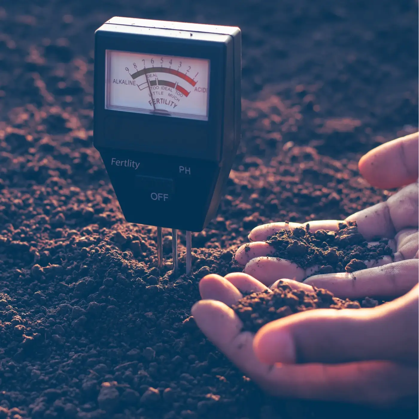
Qualitative measurements - chemical-physical parameters (air temperature, water temperature, pH, conductivity, dissolved oxygen);
Qualitative measurements - chemical parameters (TSS - Total Suspended Solids, COD, Total Hydrocarbons, PAHs, Total Surfactants, Aluminium, Total Chromium, Nickel, Zinc, Cadmium, Lead, Calcium, Chlorides, Sulphates).
Quality measurements - chemical and microbiological parameters (Nitrates, Nitrites, Ammonia, BOD5, Escherichia Coli).
Misure qualitative – parametri biologici (MHP Multi Habitat Proporzionale)
Hydromorphological measurements (river function index IFF)
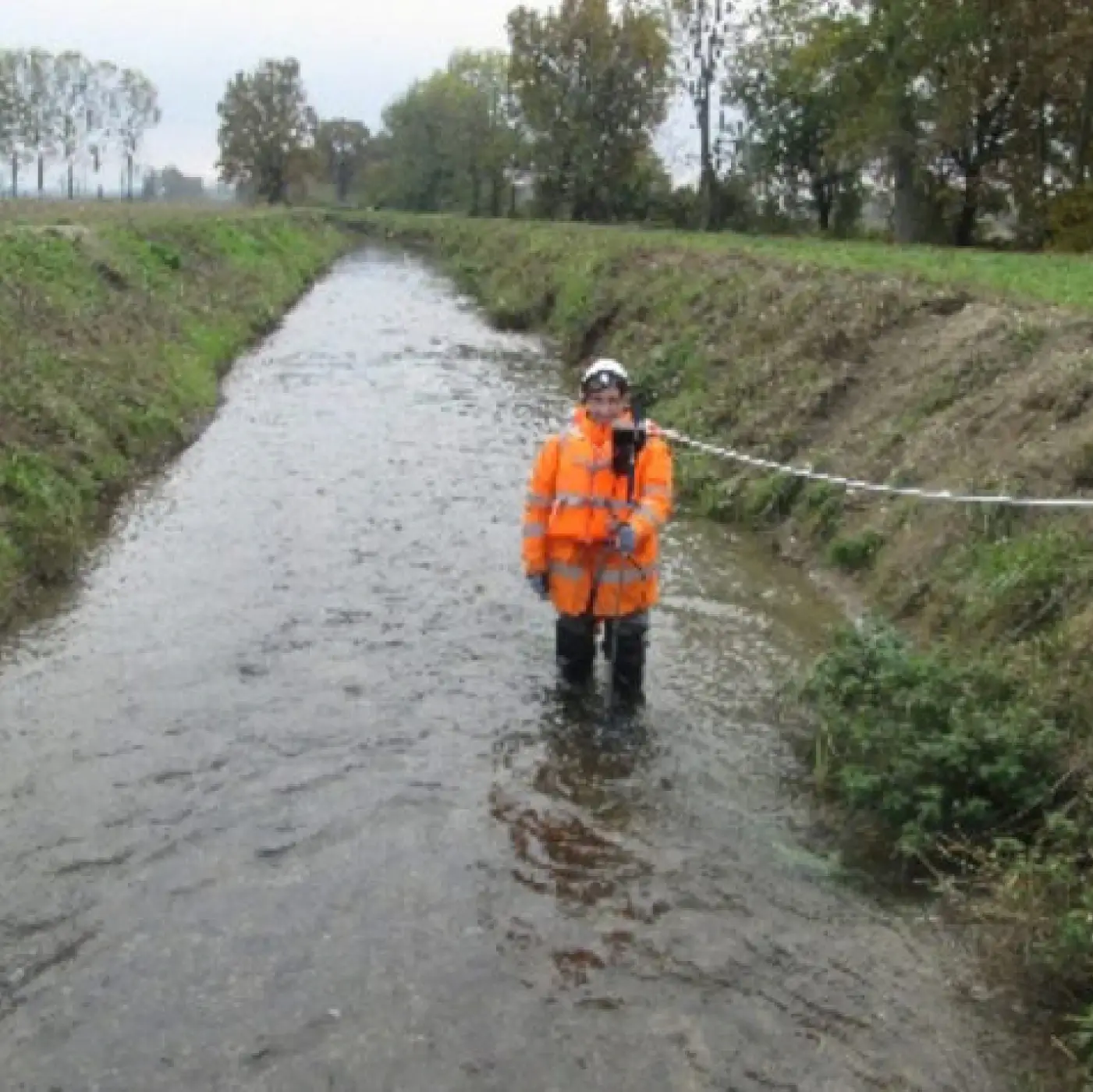
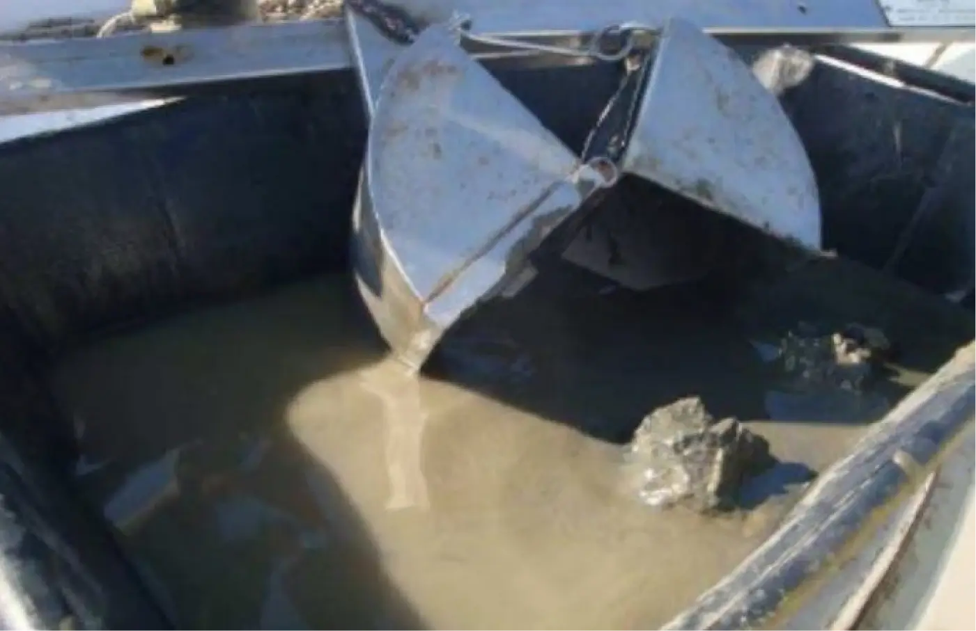
Doppler current meter flow measurement quantifies the extent of outflows, providing data that can be related to the hydrological regime of the watercourse as well as the chemical and physical parameters of water quality, to assess the extent of pollutant loads flowing into the control section. During the measurements, the flow rate will be measured using current measurements. These measurements are usually carried out with Doppler Equipment (Doppler current meter). It is planned to perform flow rate measurements on all 41 river sections included in the Environmental Monitoring Plan, which are located in the area subject to intervention.
Sampling for chemical, microbiological, biological, or hydromorphological measurements on 22 river sections affected by the works and included in the Environmental Monitoring Plan has been planned.
A total of 41 river sections were included in the Environmental Monitoring Plan, of which
19 sections concern surface water bodies subject to potential interference of a quantitative nature due to the excavation of the tunnels: Measure A1 is planned for these sections
22 sections concern surface water bodies subject to potential qualitative and quantitative interference linked to the construction site: In these sections, a site-specific combination of analytical sets A1/A2/A3/A4/A5/A6/A7 is planned.
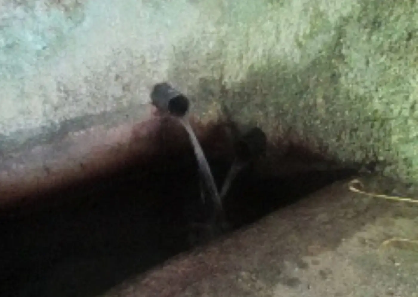
The presence of important underground works in the project, capable of altering the underground water flow regime, together with a hydrogeological criticality due to the interference of these works with the present aquifer, requires the inclusion of the Underground Water component in the Environmental Monitoring Plan.
Quantitative measurements, i.e. piezometric level on wells and piezometers, volumetric flow rate on springs or water flows in tunnels;
Quality measurements - chemical-physical parameters (turbidity, temperature, pH, conductivity, dissolved oxygen, Redox Potential);
Quality measurements - chemical parameters (Bicarbonate, Calcium, Magnesium, Potassium, Sodium, Sulphates, Chlorides, Nitrates, Silica).
Qualitative measurements - microbiological parameters (E. coli).
Qualitative measurements - chemical and microbiological parameters on water drained from the tunnels (Aluminium, Chromium, Chromium VI Iron, Manganese, Copper, Nitrates, Bicarbonate, Calcium, Sodium, Magnesium, Potassium, Sulphates, Chlorides, Total hydrocarbons)
The Chemical and Physical parameters continuously monitored by the probe are water temperature and volume flow rate.
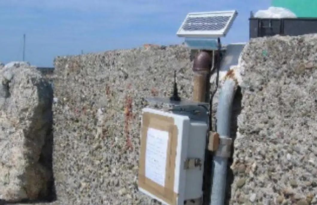
It is planned to install about 15 continuous monitoring stations, during the construction phase, on as many groundwater wells located in the area under intervention among those with the highest risk of interference.
Groundwater sampling is planned for 161 sites
The presence in the Maritime Work made it necessary to include the Marine Water component in the Environmental Monitoring Plan.
Continuous current meter in the Calma Canal measures current speed and direction;
Continuous monitoring of chemical and physical parameters (turbidity, temperature, pH, conductivity, dissolved oxygen) through the installation of three multi-parameter probes;
Quarterly monitoring of marine waters at no. 3 sampling sites (Total Suspended Solids; Total Hydrocarbons; PAHs; Total PCBs; Anionic Surfactants; Non-Ionic Surfactants; Total Surfactants; Total Chromium; Nickel; Zinc; Cadmium; Lead; Mercury; Arsenic; Copper; Selenium; Iron).
Six-monthly monitoring of marine sediments at no. 4 sampling sites (Total Hydrocarbons C>12; PAHs; Total PCBs; Granulometry; Total Chromium; Nickel; Zinc; Cadmium; Lead; Mercury; Arsenic; Copper; Selenium; Iron).
Quality measurements - chemical and microbiological parameters (Nitrates, Nitrites, Ammonia, BOD5, Escherichia Coli).
Qualitative measurements - biological parameters (MHP Multi Habitat Proportional)
Hydromorphological measurements (river function index IFF)
Some of the chemical and physical parameters continuously monitored by the probe are temperature, pH, turbidity, etc. Three measuring points are planned along the Calma Canal in an eastern, central and western position, the micro-location of which will be agreed with the Control Authority
The purpose of installing a current meter is to continuously measure the direction and speed parameters of the current over the entire water column and, consequently, to allow assessments of the current generated by the wave motion incident upon the airport stretch of water. It is planned to install a current meter at 1 site located in the centre of the Calma Canal
Water samples will be collected at known depths using Niskin-type bottles positioned in the middle of the water column. For marine sediment sampling, a bucket capable of collecting a minimum volume of 5 liters of sediment will be used.
There are 4 planned measuring points: 3 along the Calma Canal in eastern, central, and western positions, and 1 at the mouth of the Varenna stream. The specific location for the Varenna stream measurement will be agreed upon with the Control Authority.
Method A2: Measurement of total suspended dust (PTS) and PM10 particulate matter for 15 days in the vicinity of construction sites;
Method A2bis: Survey of asbestos fibres with sequential sampler
Method A3: Continuous measurement with fixed air quality monitoring unit.
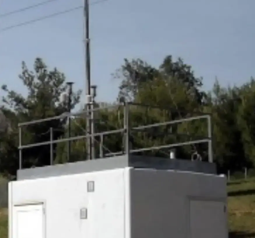
The control unit continuously monitors a set of chemical and meteorological parameters, such as nitrogen, carbon monoxide, wind, and precipitation.
One measurement point is planned, and its location will be agreed upon with the Control Authority. For dust monitoring, the unit tracks total suspended particles, PM10, and asbestos fibers. Twelve measurement points are planned, and they will be located throughout the area covered by the intervention.
Short-term measures aimed at reducing discomfort to people;
Short-term measures aimed at mitigating structural damage.
8-channel Sound Level Meter Integrator, Recorder and Real Time Analyzer for noise and vibration measurement, analysis, and monitoring. This tool can measure parameters. There are 14 measurement points located in the intervention area.
24-hour measurements, semi-fixed partially manned workstations, to survey site activities
7-day measurements, unmanned fixed stations, for vehicle traffic surveys;
Short-term measurements in the living environment to verify the differential limit;
Short-term measures in the living environment to verify direct mitigation interventions on receptors.
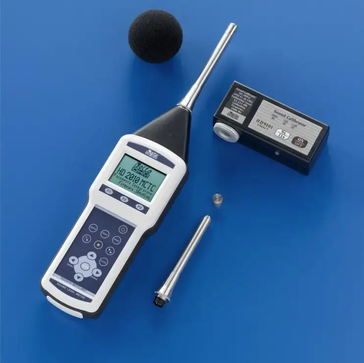
The equipment used to assess noise pollution is an integrating sound level meter. It can measure a very large number of parameters. It is planned to have 32 measuring points spread over the area covered by the intervention.
The potential impact on vegetation from the construction and operation phases of the motorway upgrade will be determined using the following monitoring methodologies:
A phytosociological survey essentially consists of describing the vegetation based on the plant species that constitute it, specifying the composition and structure of the plant stand also by defining the quantitative relationships between individual species
The survey takes place both through the use of vegetation maps and field trips, and leads to the subdivision of the watercourse into homogenous vegetation sections.
For each monitoring site of the vegetation component, an inspection is conducted in the area adjacent to the worksite, in order to check and note on special control sheets the general aspects of the impacted area, and in particular the general state of the habitat, the morphological alterations of the area, the presence of foreign material or invasive species, etc.
For the monitoring of the vegetation component, specific equipment is not foreseen; the surveys will be carried out by botanical experts. Twenty-three monitoring sites are expected to be located on the area covered by the intervention.
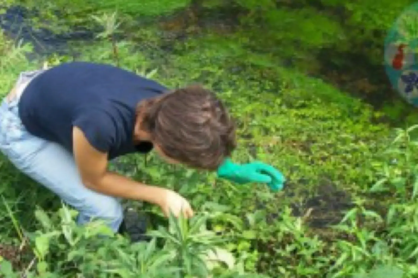
Monitoring is based on the analysis of the zoological groups that are indicated in the Environmental Impact Study as being most exposed to disturbance from works.
The groups proposed for monitoring are listed below:
The surveys will be aimed at the qualitative definition of the community present and the observation of changes in the population.
Observations are to be carried out along the river shaft, from the mouth of the watercourse to an area upstream of the impacted area.
The surveys will be aimed at the qualitative definition of the community present, with quantitative data collection on the species and the evolution of the populations during work interference.
These organisms are closely related to the cave environment, and adapted to living in the dark, in an unventilated atmosphere, with high humidity and a quite constant temperature.
For the monitoring of the Fauna component, the use of specific equipment is not foreseen; the surveys will be carried out by highly specialised operators for each fauna group investigated.
Twelve monitoring sites are planned to be located in the area covered by the intervention.
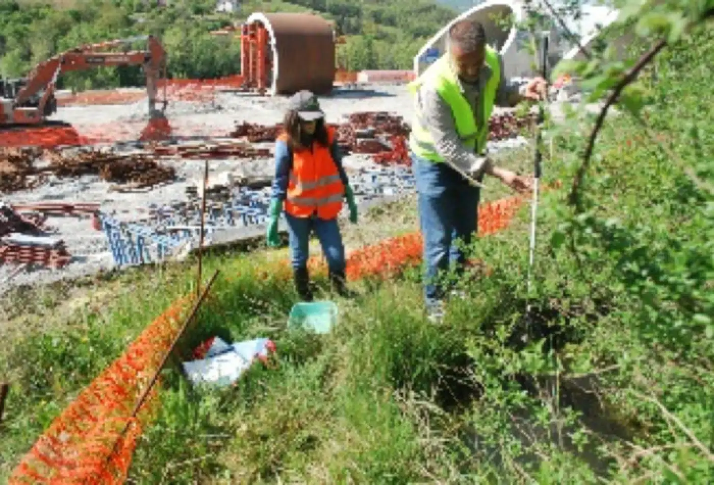
The monitoring methods take into account the geological and geomorphological conditions of the areas impacted by the construction, as well as the mechanical properties of the rock formations and the factors influencing the movement of landslides identified and studied during the design phase. These methods are designed to offer guidance for observing and analysing ongoing phenomena, and to gather data for developing mitigation measures and assessing the effectiveness of planned or ongoing consolidation and stabilization efforts.
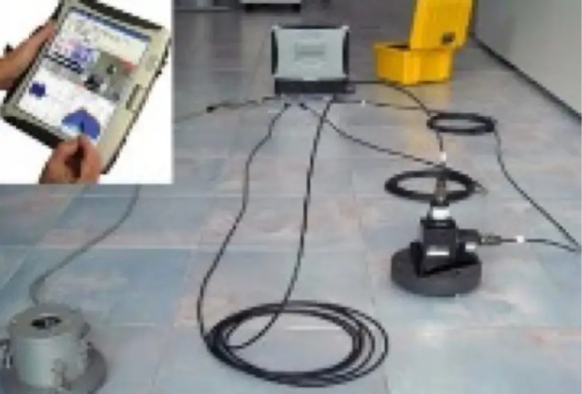
The following methods are widely used in geotechnical monitoring of the land. They are used to evaluate fluctuations in groundwater levels, monitor landslide movements, and identify sliding surfaces. These two activities are considered complementary, so inclinometer measurements are often used alongside groundwater level monitoring at most sites.
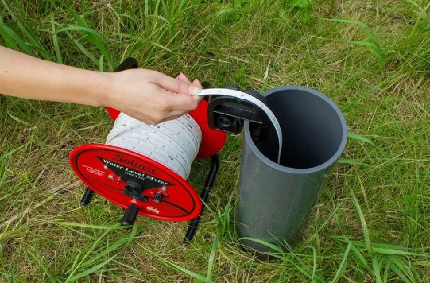
This tool can measure the static piezometric level and the groundwater level from ground level. There are 29 measuring points located throughout the area covered by the intervention.
This tool can measure the extent and speed of movement. A total of 29 measuring points is planned throughout the area covered by the intervention.

With regard to the atmosphere component, considering the presence of natural asbestos in some of the formations affected by the excavations, asbestos monitoring is planned as part of the activities of the environmental monitoring plan shared with Arpa Liguria.
In detail, the integrated environmental monitoring plan has the following objectives:

analyse ante operam conditions in order to understand existing environmental dynamics;

ensure the control of specific situations, so that work can be adapted to particular environmental and social needs;

verify the environmental interferences that may occur as a result of the construction of the work, distinguishing them from the alterations induced by other natural factors or those linked to human activities in the area unrelated to the motorway works;

report the occurrence of any emergencies in order to prevent the development of events compromising the environmental quality of the area;

verify the effectiveness of measures taken to mitigate any impacts induced by the motorway works;

control the commissioning phase of the works.
To ensure the accurate assessment of the impact of motorway construction on the environment, particularly the effectiveness of the included mitigation measures, the environmental monitoring plan will be conducted in three distinct phases.:


prior to the commencement of works lasting at least 12 months, to verify the environmental state of the sites in their current condition not yet affected by construction activities;

which accompanies the duration of works, which is estimated to be about 10 years, necessary to carry out environmental monitoring on the territory and assess the effects of the construction;

following the completion of the works, lasting 12 to 24 months depending on the environmental components examined, to verify compliance with the limits set by the regulations and to take action on the optimisation of the planned mitigation works.
For the environmental survey, we will use standardized methods for each component to ensure compliance with regulations and consistent results. In addition to mobile instruments used by our technician teams, there will also be fixed instruments in place.
CONSULT THE FINAL DRAFT OF THE ENVIRONMENTAL MONITORING PLAN